These photos were taken in the early 1930s (the Macon crashed
in February 1935), except for the last few at the bottom of the page.
Macon from the air. James McCall of Texas
saw this web site and donated this remarkable photo to the Museum, which
I have enlarged 250%. It was removed from a photo album and given to Mr.
McCall by Mr. Ragland. While there are probably other photos taken from
the air which show the Macon on the ground, this is the only one I have
seen. It's extraordinarily interesting for the story it tells.
I have not retouched the photo at all, so you can see the tears and stains.
This is my subtle way of letting you know that even an item that appears
to have little interest or value may fill a very important hole in a museum
collection. Indeed, this photo is of such importance - in my opinion - that
I hope the Museum will see fit to make an enlarged copy for sale to the
public.
(Center photo @ 750%) Here we see the Macon on the landing circle about
to take off (a guess - I don't know for sure, of course). From the shadows
I'd guess it's about noon. The Macon is hooked on to the mooring mast. A
few sailors hang around the bow and there are bunches of sailors back by
the tail. The Macon had to take off and land facing the wind, and from the
wear pattern of the landing circle we can see that the right side of the
circle got little if any use.
Visible to the right of the hanger is the Sparrowhawk path out to their
runway (white rectangle at center right). Under magnification (bottom photo
@ 2500%) five planes are visible lined up on the path, very likely preparing
to take off. (They would hook up with the Macon high in the air and be drawn
inside the ship, one by one. There they would have their wheel assemblies
removed and replaced with long range fuel tanks, so they could scout quite
some distance away from the Macon. When the mission was over the process
would be reversed.) Some of these planes are still on board the Macon today,
at the bottom of the Pacific Ocean, off Point Sur, California, where she
crashed February 12, 1935.
(See the article on the Macon's rediscovery in National Geographic, January
1992.)
(Top photo) In the foreground is Bayshore Highway, lined on both sides
with cars watching the Macon. (Possibly my parents are among them - my mother
used to tell me about watching the Macon.) The road joining with Bayshore
at bottom right is Ellis Street, which today is the second entrance to the
Base. The thin line running parallel to Bayshore and curving into Ellis
St. is the Base railroad track. Just at the left edge of the photo the track
turns and heads towards the Base buildings.
In the rear is lower San Francisco Bay.
 Macon over hangar
at Moffett Field.
Macon over hangar
at Moffett Field.
Just over her rear is the town of Mountain View.
 Macon crew in hangar. Notice the sailor poking his head out of the left
(viewer's right) gondola window.
Macon crew in hangar. Notice the sailor poking his head out of the left
(viewer's right) gondola window.
The curving framework on both sides of the photo are the hangar elevators.
 Macon in hangar at Moffett Field. While the hangar is enormous inside, as
modern photos will show, with the Macon inside it looks just a bit claustrophobic.
Macon in hangar at Moffett Field. While the hangar is enormous inside, as
modern photos will show, with the Macon inside it looks just a bit claustrophobic.
 Macon
facing hangar at Moffett Field.
Macon
facing hangar at Moffett Field.
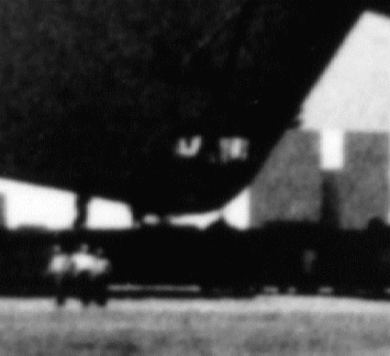 Closeup of the Macon's rear control room (very blurry).
 "Sparrowhawk"
fighter. Below are probably farmlands and orchards of Mountain View
and Sunnyvale, now a part of Silicon Valley.
"Sparrowhawk"
fighter. Below are probably farmlands and orchards of Mountain View
and Sunnyvale, now a part of Silicon Valley.
 Sparrowhawks
over Moffett Field. The road leading upwards at the right is Bayshore
Highway (now 101 Freeway), leading towards San Jose. Behind the closest
Sparrowhawk is the Sparrowhawk runway and the plane path into the hangar.
(Can someone give me a better word than "plane path"?)
Sparrowhawks
over Moffett Field. The road leading upwards at the right is Bayshore
Highway (now 101 Freeway), leading towards San Jose. Behind the closest
Sparrowhawk is the Sparrowhawk runway and the plane path into the hangar.
(Can someone give me a better word than "plane path"?)
 Moffett
Field from the air. Bayshore Highway leads upwards on the right towards
San Jose.
Moffett
Field from the air. Bayshore Highway leads upwards on the right towards
San Jose.
 Hangar
#1 in 1933. The airship in the background sky has been identified elsewhere
as the Macon, but it's shape and the gondola's location show it to be a
blimp. I believe it was added later for "effect".
Hangar
#1 in 1933. The airship in the background sky has been identified elsewhere
as the Macon, but it's shape and the gondola's location show it to be a
blimp. I believe it was added later for "effect".
 Ca.
World War II - Future airshipmen in training on a manned balloon; a
blimp in the background.
Ca.
World War II - Future airshipmen in training on a manned balloon; a
blimp in the background.
 Ca.
World War II - A flight of blimps
Ca.
World War II - A flight of blimps
 A Military Air Transport Service DC-4 over Moffett Field,
ca. late 1940s. The two huge hangars at top right were built in 1942 and
still exist.
A Military Air Transport Service DC-4 over Moffett Field,
ca. late 1940s. The two huge hangars at top right were built in 1942 and
still exist.

Free counters provided by Honesty.com.
Number of visitors to this page since
October 6, 2001